The European Sentinel-1 Earth observation satellite covered the location of the FRAM 2014-15 expedition on 13. July.
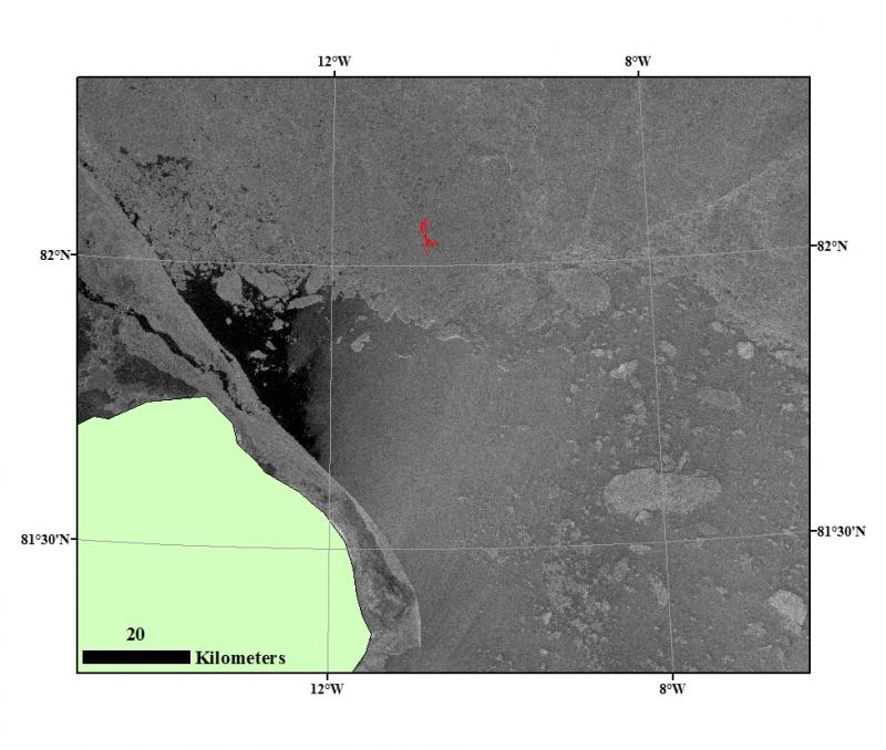
The Synthetic Aperture Radar (SAR) image has a resolution of 80 meter and superimposed is the drift trajectories of Sabvabaa during the last two days.
