(03 Aug. - 09 Aug. 2015)
New web-site: http://sabvabaa.nersc.no for updates
See the web-site: http://www.aari.ru for the Russian ice drift station North Pole - 2015
Towards the end of an expedition
As the FRAM-2014/15 ice drift was approaching the marginal ice zone and the ice activity was expected to intensify, we terminated the data acquisition on 03 July 2015 (Fig. 1, upper panel, point marked with black "X"). The surrounding ice field with abundant pressure ridges was too difficult for any diesel driven icebreaker to reach our location with a reasonable effort. An attempt to transfer the cargo to Polarstern by helicopter on 06 July was aborted due to the separation between the ship and the camp. Our option to use the sealing vessel Havsel was subsequently reaffirmed, but the vessel would not become available until mid-August. To make use of the interim period, the plan was to drive the hovercraft to Independence Fjord and work there in cooperation with the new Villum Reseach Centre.
The hovercraft left the FRAM-2014/15 camp on 08 July heading north, but advanced only 4 nautical miles before the ice became too difficult and a mechanical problem surfaced. The propeller pitch loading problem was partly fixed within the following week. However, the ice conditions to the north were too difficult for hovercraft driving, and remained so for the next four weeks. As time progressed, the separation between the location of the hovercraft and the abandoned ice camp increased to over 20 nautical miles. Since the ice conditions to the west were considerably better, it was decided on the 28 July to drive towards the landfast sea ice to the west near Krøyer's Holmer, a distance of 25 nautical miles and wait for the drifting ice camp to catch up (Fig. 1, lower panel). It now became clear, that the remaining amount of fuel would not be sufficient to reach Station Nord in Independence Fjord.
Unfortunately, the ice field including the ice floe with the abandoned camp site, did not show any significant southward drift, but kept moving back and forth in an East-West direction at the northern end of what is known as the Northeast Water (polynia) (Fig. 2). At the same time, a narrow belt of drifting sea ice kept blocking any attempt to leave the location near the southeastern part of Krøyer's Holmer where the hovercraft was temporarily parked (Fig. 3).
The situation changed on the 08 August (Fig. 4, upper panel). Guided by the fantastic tools represented by satellite imagery and the global positioning system, we downloaded an image obtained by the Sentinel-1 satellite that day from the http://ocean.dmi.dk web-site and geo-referenced it by assigning latitude and longitude to a limited number of locations on land. The image was then transferred to our navigation PC and overlaid the hovercraft GPS navigation (Fig. 4, upper panel).
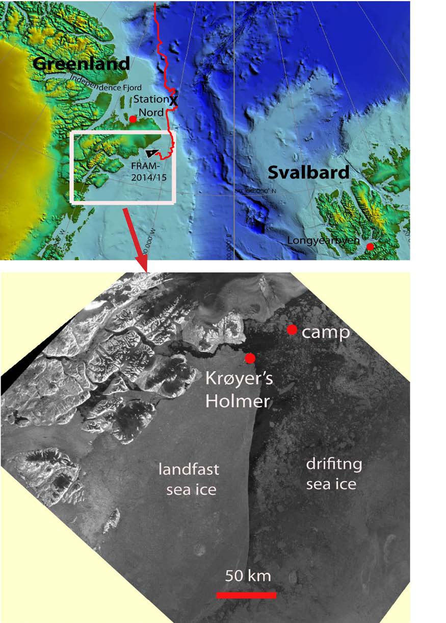
Fig. 1. Upper panel: Location map with the drift track of FRAM-2014/15. The black letter "X" marks the termination of the science program. White frame refer to area of the satellite image below.
Lower panel: Sentinel-1 satellite image for 08 August obtained from http:// ocean.dmi.dk
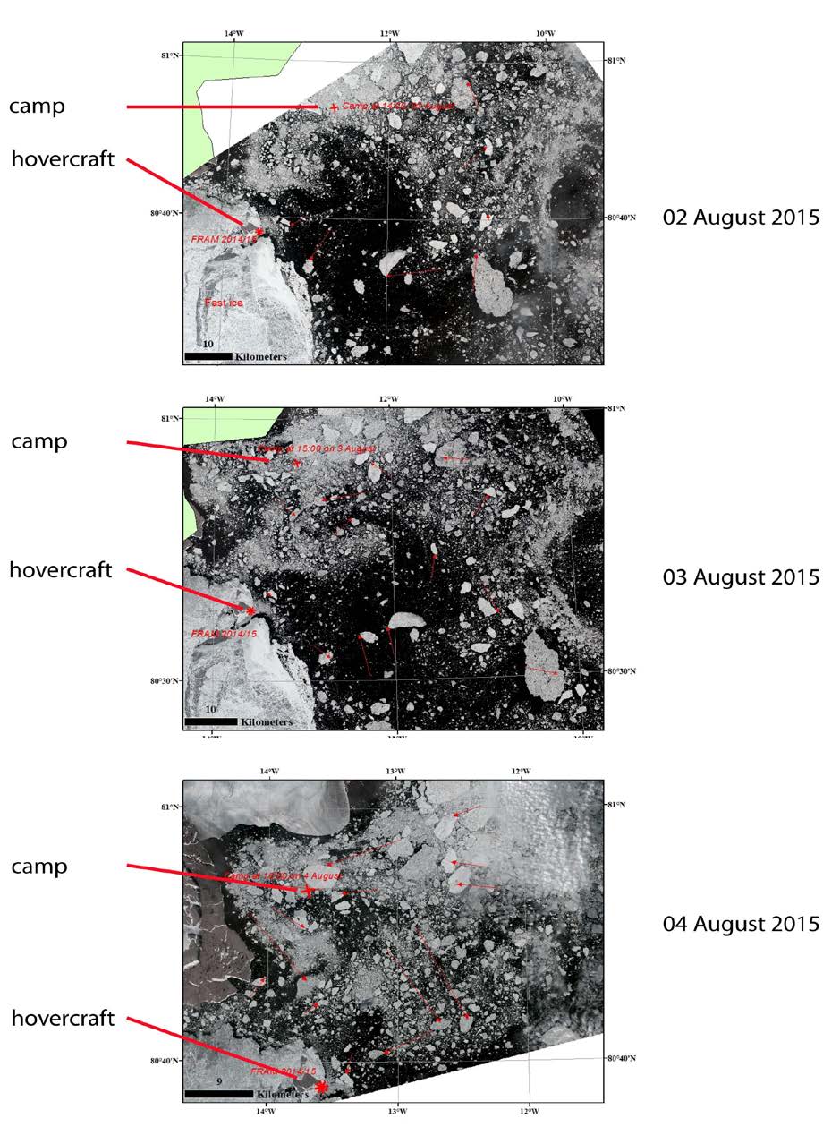
Fig. 2. Landsat images displaying the ice situation during the first part of week 49. Image processing courtesy of M. Babiker, NERSC.
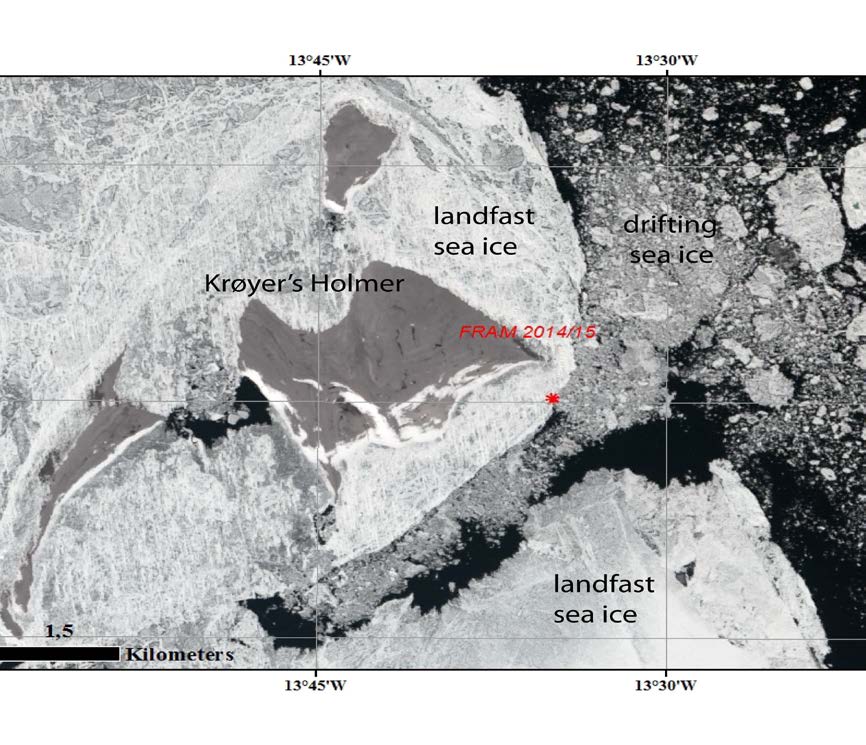

Fig. 3 Upper: Landsat image with details of the ice distribution around Krøyer's Holmer. Position of the parked hovercraft indicated by red star. Image processing courtesy of M. Babiker, NERSC
Lower: View from the nearest of Krøyer's Holmer of the hovercraft parking site. Landfast sea ice in the foreground and drifting sea ice beyond the hovercraft.
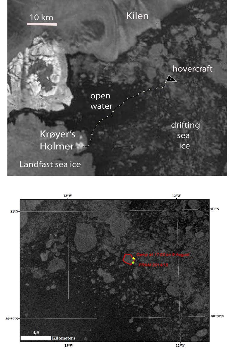
Fig. 4. Upper: Sentinel satellite image from 08 August (http://ocean.dmi.dk) overlaid by GPS navigation. The image was acquired one day before the trip was made.
Lower: Sentinel satellite image obtained the same day as the trip was made. Yellow "X" indicate camp location at the time of image acquisition and yellow "dot" indicate the position of the hovercraft . Image processing courtesy of M. Babiker, NERSC.
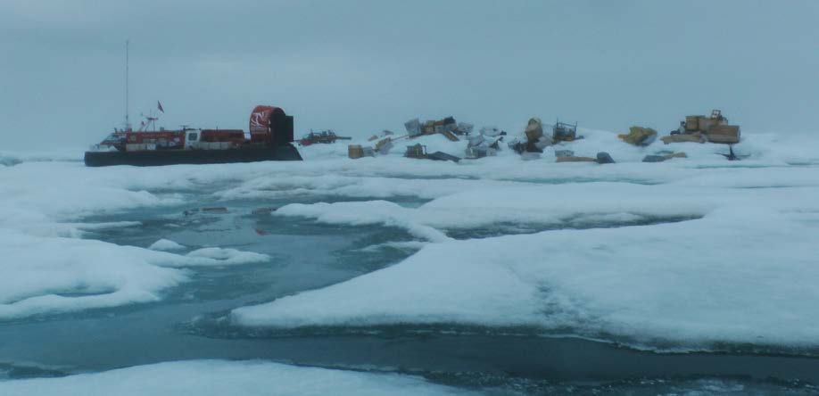
Fig. 5 Back in camp after 32 days "on the run".
We could now drive directed by the information of the sea ice distribution displayed in the satellite image, and the target was the position of the abandoned camp derived from a satellite tracker. The tracker position was obtained from our web-site hppt://sabvabaa.nersc.no. The transit was made in dense fog on Sunday 09 August. We encountered a large ice floe near the target location and decided to park and wait for the visibility to improve. Four determinations of the separation between the hovercraft and the camp showed 694- 720 meter (Fig. 4, lower panel). We moved on the next day and found the camp intact at the edge of the large floe (Fig. 5).
The sealing vessel Havsel is expected to arrive about 17 August.
Wild life
Kittiwakes were in abundance at the easternmost of Krøyer's Holmer. We have not seen a single bird at the location of the camp. Two walruses were seen on the way from the landfast ice.
Life in the High Arctic treats me well.
Yngve Kristoffersen