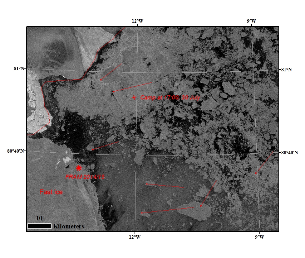
The sea ice condition around FRAM 2014-15 from Sentinel-1image of the 30 July at 16:59. The icedrift displacement for the last 30 hours is indicated -it shows west to south-west directions. The camp at 17:00 are demarcated (x).
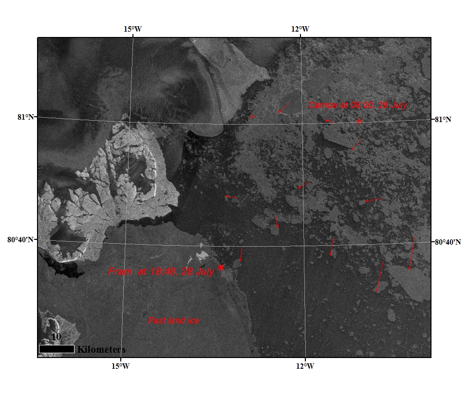
Sabvabaa (*) is now located on the edge of the landfast ice approx. 3.1 nm southwest of Henrik Kroyers Holme.

The sea ice condition around FRAM 2014-15 from Sentinel-1image of the 29 July at 08:09. The icedrift displacement for the last 15 hours is indicated -it shows different magnitude and directions.
Sabvabaa is now located on the edge of the landfast ice approx. 3.1 nm southwest of Henrik Kroyers Holme.

The sea ice condition around FRAM 2014-15 from Landsat image of the 28 July at 15:57. The icedrift displacement for the last 24 hours is indicated -it shows different magnitude and directions.
Sabvabaa is now located on the edge of the landfast ice approx. 3.1 nm southwest of Henrik Kroyers Holme.

7 hours drive to the edge of the landfast ice 3.1 nm south of Henrik Krøyers Holme.
Position: 80 36.50'N 13 24.07' W

The sea ice condition around FRAM 2014-15 from MODIS image of the 28 July. The icedrift displacement for the last 24 hours is indicated. Fram 2014-15 and the camp at 07:00 are demarcated.

The sea ice condition around FRAM 2014-15 from Landsat image of the 27 July at 15:15. The icedrift displacement for the last 7 hours is indicated -it shows different size and directions, around Fram is North to North-west direction. Fram 2014-15 position at different time is demarcated and it is drifting North. the camp at 17:00 are demarcated.

28/7-2015: Position @ 0715 GMT: 80 53.68' N, 11 01.75' W
- 1 °C, 1022 hPa, wind 11 kts from WSW, icedrift 0,4 knot cycloid.

Position at 1705 GMT: 80 50.81' N, 10 57.93' W
Temp -2 °C, 1022 hPa, wind 10 knot from SSW, ice drift 0.8 knot 350 degrees.

26 juli 1430 GMT 80 45.47' N, 10 47.6' W,
+ 2 degree C, 1019 hPa, wind 3 knot from the SE, ice drift 0.3 knot in cucloid pattern.